Montessori schools generally choose to study the continent on which the school is established as a first continental exploration. As we currently live in Europe, we thus focused on Europe last month but I felt we really ought to learn about North America this month as we probably will spend most of our lives there. After having made up my mind that North America would be the second continent of the year, we of course booked and went on a trip to Asia and should probably have studied THAT continent instead! :) Oh well, Adrian knew quite a bit about Asia and the countries we visited anyway...
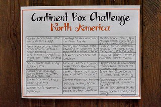
I decided early on NOT to make continent boxes. I know...it's very unusual not to have one of those in a Montessori setting but I am guiding only two children and at this time, only Adrian is using geography materials. Putting together boxes takes a while and I always felt like those treasure boxes were under-explored and sometimes plain overlooked. To avoid my hard work going to waste, I decided to present the continents through various activities that could have been found in a continent box...but on trays. If you prefer to do a continent box and want to put the chances on your side, you might want to pay a visit to 1+1+1=1. Carisa "tricked" her children into exploring her continent box by offering them a "challenge". Who doesn't like a challenge? I had to borrow the template sheet for that despite the fact that we had no box! (I knew Adrian would be delighted to cross things off as he went through them at least once.)
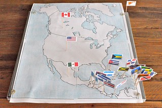
Every time we "visit" a new continent, I plan on having pin flags and a big size map of the continent. I get all my pin flags from Montessori Print Shop. I find that it saves me lots of time from making my own. For big maps, I rely on Your Child Learns. It allows me to print a map on several pages (I usually have mine printed over four). Remembering how tough it had been to pin the flags into a corkboard sheet during the European unit, I decided to put the North America map on a regular foam/mesh billboard this time. It worked great and we avoided many frustration of toothpicks breaking or not going in. The only problem is that it got quite crowded in the Caribbean area...
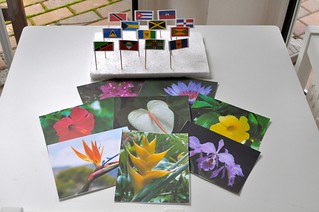
While studying the flags of North America, I noticed my son had more trouble identifying the ones from the Caribbean countries. I can't blame him. Lots of flags in such a small space compared to the "North". To help him, I prepared a few activities more specific to the area where he got to manipulate only the Caribbean flags. Having been to the Caribbean, I remember the colorful and fragrant flowers of the islands and thought I'd make an activity out of it. I printed pictures of various species and put the flags on a styrofoam board. Adrian and I then explored the flowers by name and I then told him that each flower had been photographed in a different Caribbean country. I let him pick a picture, told him where it'd been taken and asked him to pair the flag of that country to it. If he had been a reader, I would simply have put the name of the country on the card but we're not at the level yet.
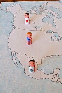
Using the same big format map as we had earlier this week, I got some flag peg people out for country matching. I've only made three for North America and they were rather easy for Adrian to place on the map but he still loves those peg people! :) I'm looking forward to an end of year challenge where the dolls from all continents come out! :) If you've missed my post on these lovely flag peg people, please read more on these here.
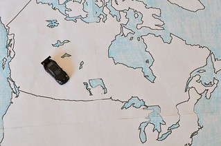
As a way to practice country names and geographical location, the big map was put to use more than once this week as you can see. In this activity, a small car was used for a "road trips". For readers working with a partner would be great but as I'm working with a non-fluent reader and no other children, we did the game orally instead of written down on cards. I would give Adrian a point of departure, stops along the way and a final destination. His car would have to go through all the points as I mentioned them. His car was lucky enough to even take the ferry a couple of times! :) To make it more challenging, it can be done by adding provinces and states as well.
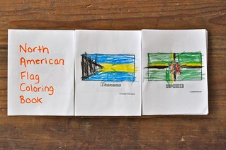 |
| Coloring Flag Book - North America |
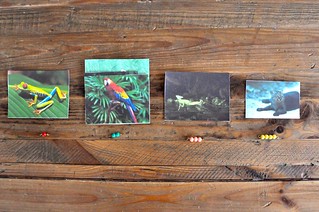
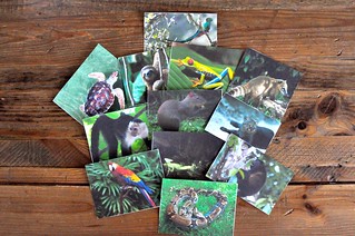
Part of our North America study incorporated a look at animals we might encounter if we were to visit Central America. After the 3 period lesson and a few days had elapsed, the cards were used again for another language activity: syllable counting. Our animals ranged from 1-4 syllables (frog, macaw, basilisk, jaguarundi, etc). Below, you'll see all the animals used in this activity. By the way, I've made these cards myself using pictures found online and here's the full set:
* * *
Your comments make my day !
(...but won't be visible until after approval due to increased spam...)
* * *
This week, I'm happily linking up to
Montessori Monday, The Kids Co-Op, Show-and-Share Saturday, Link & Learn, TGIF, Share it Saturday, Mom's Library, The Sunday Showcase, Tuesday Tots, Preschool Corner &5K, We Made That.
No comments:
Post a Comment